Monday, March 30, 2009

Proportional Circle Maps


Proportional circle maps display data in relation to the size of the circles.
The image on the right is a proportional circle map.

Choropleth Maps


thematic maps based on predefined aerial units. Some maps show many types of data while thematic maps are made to show only one specific set of data. Because each group of data is organized as a ratio value a graded color series is used to show least intensity to most intense (shown using a light to dark color pattern).

Dot Distribution Maps


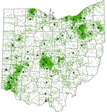
dot-distribution maps display quantitative data as a dot,representing a number of the factors found within an area. The dot distribution pattern reflects the general locations where the factor was most likely to occur. The pattern and number of dots within the area reveal the density of the phenomenon. Two types of dot-distribution maps are: first the traditional dot map showing the distribution of a phenomenon, traditional dot map symbolizes data with blue dots, second type is an increase/decrease dot map showing increasing (positive) and decreasing (negative) data values as they related to the last agricultural census. The increase/decrease dot map symbolizes data using blue dots for positive data values and red dots for negative data values.

Propaganda Maps


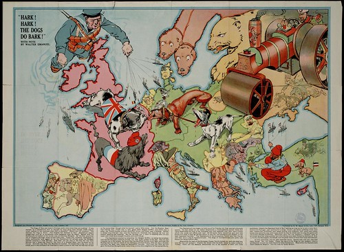
Propaganda Maps are used to persuade people to think one way or another. They are well known for their use in WWII and WWI.

Hypsometric Maps


Hypsometric maps show relief feature on the planet's surface.

PLSS Maps


PLSS maps: Public Land Survey System

maps used to divide up public lands which are owned by the Federal Government. These are created to help the citizens of the United States.

Cadastral Maps


Following the fall of the iron curtain in 1989 the post-socialist countries began to bridge the socio-economic gap between the

Cadastral maps: a map showing the boundaries of the subdivisions of land used in recording ownership, taxation, zoning, property development and public works. Although there are a number of basic components common to most systems, no two cadastral mapping systems are the same.